

Aerometrex lands $617,141 LiDAR and imagery contract in the Beetaloo Sub-basin
Aerometrex Limited (ASX: AMX) has secured a new survey contract with Tamboran B2 Pty Ltd, a Joint Venture between Tamboran Resources Corporation and Daly Waters Energy, valued at $617,141 ex GST.
The project covers approximately 7,500 km² of LiDAR and aerial imagery capture across the Joint Venture’s priority leases in the Daly Waters region, Central Northern Territory, supporting development planning in the Beetaloo Sub-basin.
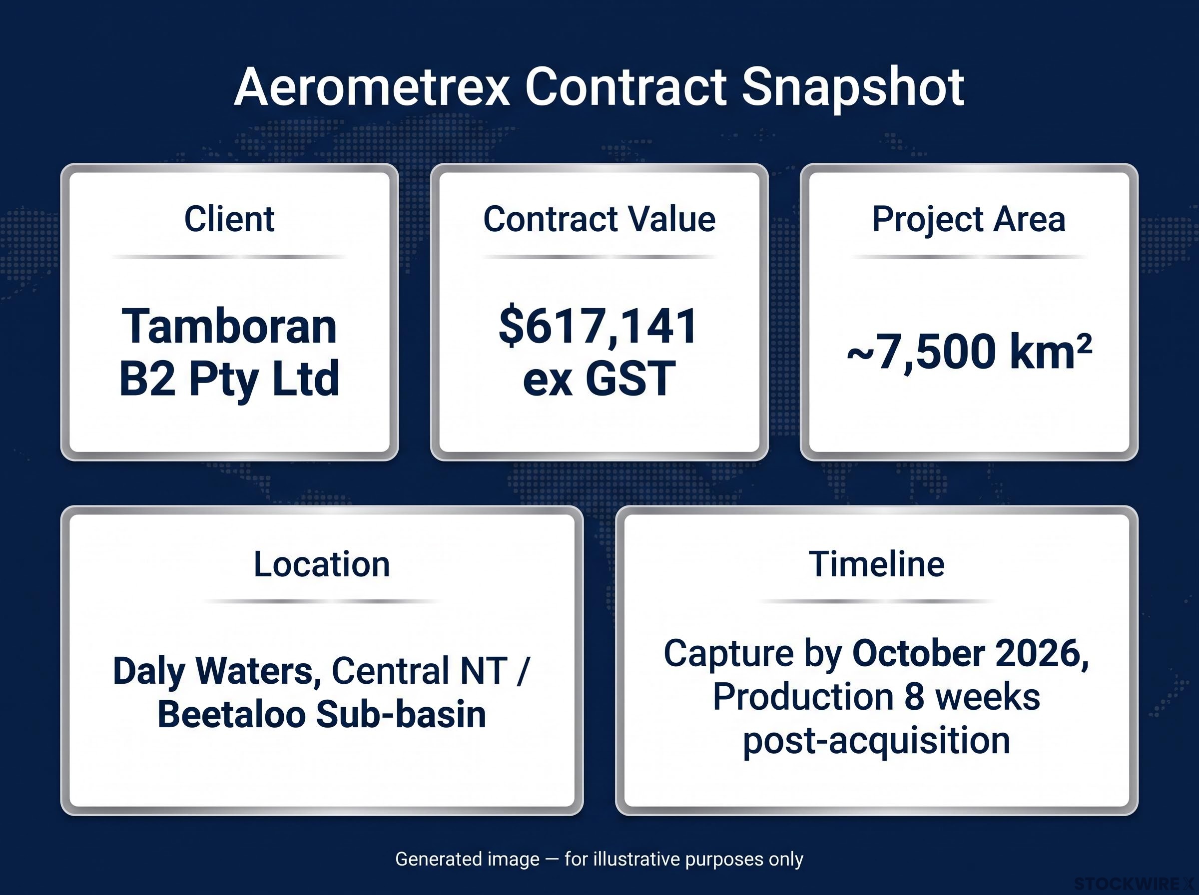
Capture is expected to commence shortly after contract award, with completion anticipated by October 2026 and production finalised approximately 8 weeks post-acquisition.
When big ASX news breaks, our subscribers know first
What the Beetaloo Sub-basin contract means for Aerometrex investors
What is LiDAR and why does the resources sector need it?
LiDAR (Light Detection and Ranging) uses laser pulses to generate high-density point cloud data, producing precise, large-scale terrain maps that are difficult to replicate through conventional surveying. Energy and resources companies rely on this technology for a range of planning needs, including:
- Terrain modelling across large, remote areas
- Infrastructure siting and corridor planning
- Environmental impact assessment and land surface analysis
- Combined with concurrent aerial imagery, providing a comprehensive geospatial dataset for decision-making
In this contract, Aerometrex will deliver both high-density point cloud LiDAR and concurrent aerial imagery, giving Tamboran B2 Pty Ltd an integrated geospatial view of its priority lease area.
LiDAR division recovery contributed $6.2 million to $6.6 million in first-half revenue, providing project-based diversification alongside the MetroMap subscription engine as Aerometrex reached a broader profitability inflection.
A repeat relationship with a resources sector client
The language used by Managing Director and CEO Rob Veitch is notable for what it signals about the nature of this engagement. His reference to the “strength of our relationship” and “another successful outcome” indicates this is not a first engagement with Tamboran B2 Pty Ltd, pointing to client retention and repeat project flow as part of Aerometrex’s commercial model.
Rob Veitch, Managing Director and CEO
“This project contract reflects the strength of our relationship with Tamboran B2 Pty Ltd and reinforces Aerometrex’s position as a trusted partner for large-scale geospatial survey work supporting the resources sector. We look forward to delivering another successful outcome for Tamboran across the Beetaloo Sub-basin.”
The Beetaloo Sub-basin is an active onshore energy development zone in the Northern Territory, where the Joint Venture holds priority leases that require detailed geospatial data to support planning activities.
Project snapshot and delivery timeline
| Detail | Information |
|---|---|
| Contract value | $617,141 ex GST |
| Client | Tamboran B2 Pty Ltd |
| Project area | ~7,500 km² |
| Location | Daly Waters, Central NT |
| Capture completion | October 2026 (anticipated) |
| Production delivery | ~8 weeks post-acquisition |
Key delivery details for this project include:
- Survey capability: High-density point cloud LiDAR combined with concurrent aerial imagery capture
- Geographic scope: Priority JV leases spanning the Beetaloo Sub-basin, a significant onshore energy development zone in the Central Northern Territory
Building a geospatial position in Australia’s energy corridor
Established in 1980, Aerometrex serves wide-ranging industries and customer requirements across three primary product lines: MetroMap, LiDAR, and 3D visualisation. This contract demonstrates active project flow from the resources sector as a revenue vertical alongside the company’s other service lines. The Beetaloo Sub-basin engagement reflects an ongoing client relationship rather than a one-off win, with the CEO’s commentary pointing to Aerometrex’s positioning as a recurring geospatial partner for large-scale energy sector survey work.
AI data licensing represents a parallel revenue stream for Aerometrex, where existing 3D and LiDAR catalogue assets are sold to technology companies at high margin without requiring any new aerial capture work.
Don’t Miss the Next ASX Industrials Winner
Big News Blast delivers FREE breaking ASX news and in-depth analysis straight to your inbox within minutes of release. Join 20,000+ subscribers already staying ahead of the market and never miss a market-moving announcement again. Click the “Free Alerts” button at StockWire X to get started today.